Wondering how fast you can be in the Gulf from a Royal Harbor dock, and whether a bridge might limit your boat? You are not alone. In Royal Harbor, the difference between direct and indirect Gulf access can shape your boating lifestyle, your transit time, and even resale appeal. In this guide, you will learn how access types work, how to estimate travel time to Gordon Pass, what to check for bridges and depths, and how to match a boat to a canal property. Let’s dive in.
Direct vs indirect: what it means here
Direct Gulf access means you can navigate from your dock to open Gulf waters without any fixed bridges, locks, or other vertical obstructions that limit your boat’s air draft. It usually means quicker transits and fewer constraints for powerboats and tall-masted sailboats.
Indirect Gulf access means the route includes one or more constraints, such as a fixed bridge with limited clearance, a movable bridge with an opening schedule, or other pinch points. If you run a sailboat or a yacht with a high radar arch, indirect routes can require timing your trip to tides, lowering equipment, or choosing a different route.
Why this matters to you:
- Boat type flexibility. Tall-masted sailboats and larger yachts are more sensitive to bridge clearances and channel depth.
- Time to the Gulf. Direct routes typically save time and reduce delays.
- Ownership costs and prep. Hurricane readiness, insurance, and maintenance plans can vary with boat size and dock setup.
- Resale appeal. Properties with broader boat compatibility may attract more buyers.
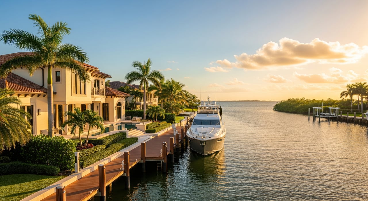
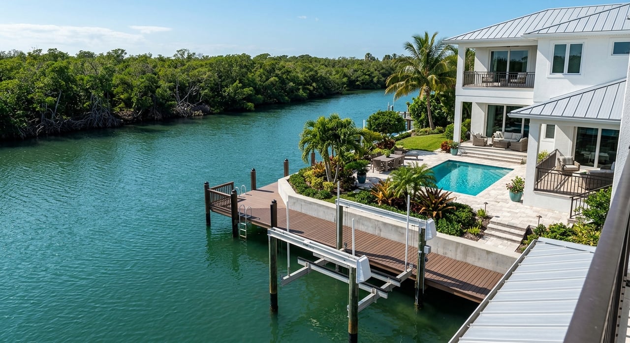
How you reach the Gulf from Royal Harbor
Royal Harbor sits on canals that feed into Naples Bay. The common route to open water is Naples Bay to Gordon Pass, then the Gulf of Mexico. Shoaling in Gordon Pass and parts of Naples Bay can change depth seasonally and after storms, so always plan with current charts and local notices.
Conceptual route:
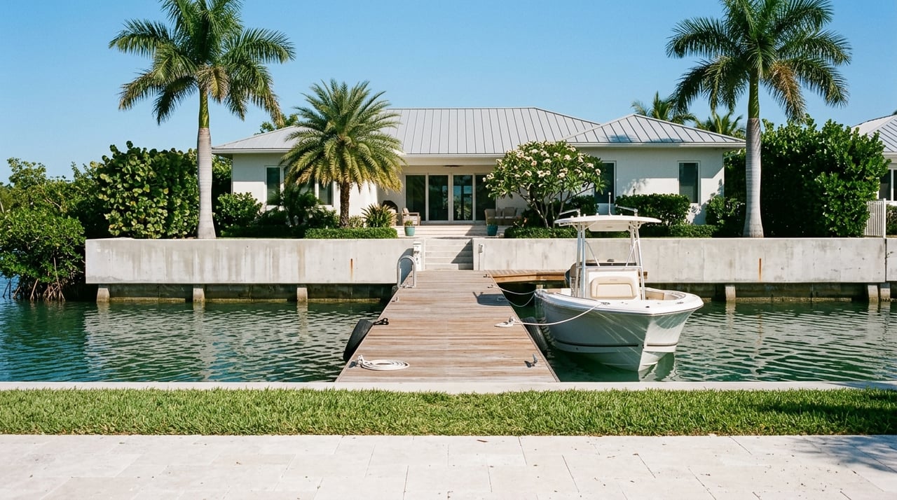
Dock (private canal)
     |
Canal/Seawall
     |
Naples Bay
     |
Gordon Pass
     |
Gulf of Mexico
Tides in Southwest Florida are modest, but even small changes can matter for boats with deeper draft or marginal bridge clearance. Build in a time and depth margin, especially after storms or dredging activity.
Calculate your travel time
Do not measure straight-line distance. Measure nautical miles along the waterway using current charts or a GPS plotting tool. Then estimate time at your practical cruising speed and add allowance for no-wake zones and canal maneuvering.
Quick conversions:
- At 6 knots, you cover 1 nautical mile in about 10 minutes.
- At 20 knots, you cover 1 nautical mile in about 3 minutes.
Example only, for context: If the measured water-route distance from your dock to Gordon Pass is 2 to 3 nautical miles, a 20-knot run could be about 6 to 9 minutes underway. At 6 to 10 knots, it could be roughly 12 to 30 minutes. Add time for idling in canals, navigating busy sections of Naples Bay, and passing through the mouth of the pass.
Bridge and clearance checks
Most Royal Harbor routes to Naples Bay and Gordon Pass do not include fixed bridges for many canal homes, but you should always confirm the exact route for a specific property.
What to verify:
- Existence of bridges. Identify any fixed or movable bridge on your exact path from dock to Gulf.
- Vertical clearance. Compare your boat’s air draft to published clearances. Confirm the datum used for the clearance, often mean high water.
- Channel depth. Check charted depths at mean lower low water and review recent dredging or shoaling notices.
- Horizontal clearance and turning room. Big-beam yachts need width and turning basins.
How to verify:
- Consult current NOAA nautical charts for Naples Bay and Gordon Pass.
- Review the latest U.S. Coast Guard Local Notice to Mariners for depth changes or aids-to-navigation updates.
- Ask the seller, HOA, or local public works about dredging history, seawall condition, and any recent surveys.
- If you own a sailboat, measure your mast and equipment to the inch, then compare to published bridge heights and your tidal window. Add a safety margin.
Match your boat to the canal
Key measurements to know before you write an offer:
- Length overall. Ensure your dock length fits your boat plus fenders and lines.
- Beam. Check slip width and the canal’s side clearance.
- Draft. Verify water depth at low tide at the slip and along the route.
- Air draft. Confirm your mast, tower, and antennas clear any fixed structures.
General fit by boat type:
- Flats and bay boats. Shallow draft, low air profile, quick to the Gulf, easy on davits.
- Center consoles and dual consoles. Popular for Naples Bay and nearshore fishing, usually fine if beam and LOA fit.
- Express cruisers and sportfish (25 to 45 ft). Need adequate depth and turning radius; confirm canal width and dock strength.
- Trawlers and passagemakers. Comfortable if depth and turning space are sufficient, with slower Gulf runs.
- Sailing yachts. Prefer direct routes without fixed bridges. If any fixed bridge sits on your path, plan for mast-lowering or choose a different property.
- Larger yachts over 50 to 60 ft. Verify deepwater access, wide turning basins, robust power pedestals, and seawall capacity.
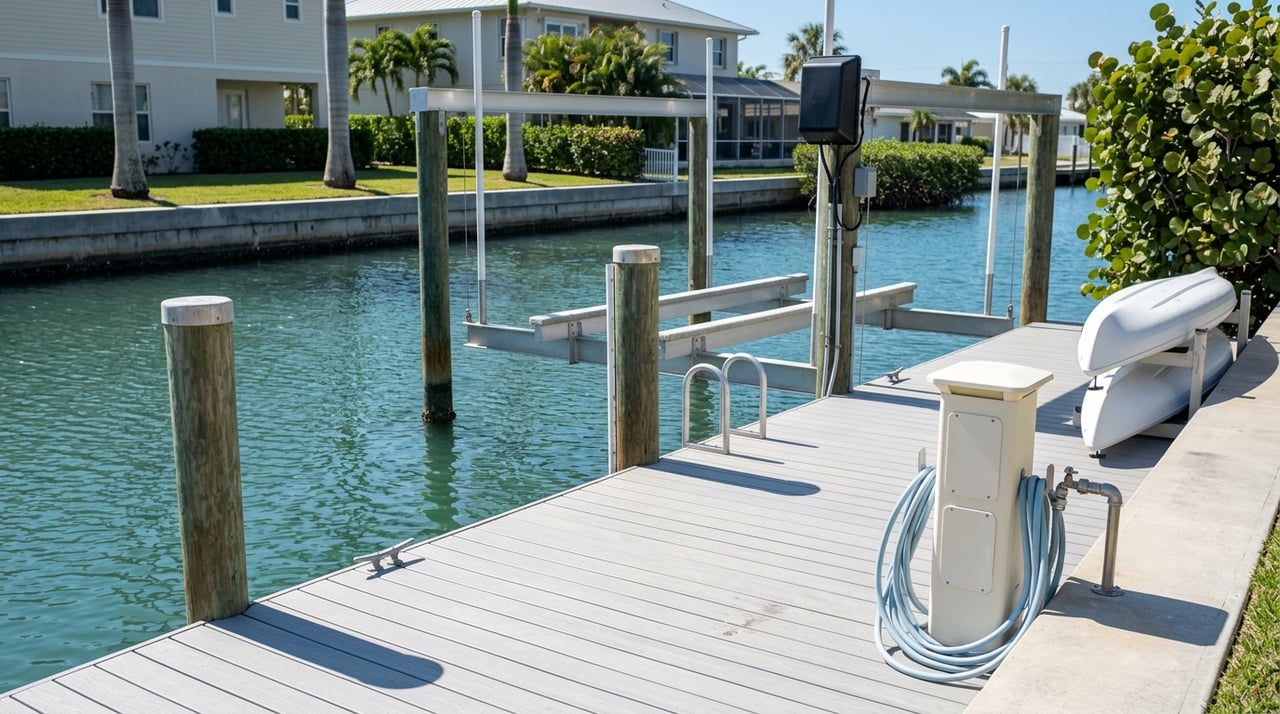
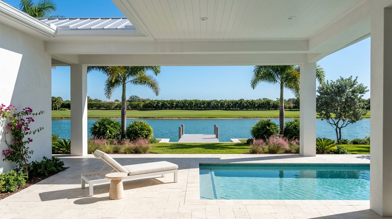
Dock and infrastructure to inspect:
- Pilings, cleats, fendering, lighting, potable water, and appropriate shore power.
- Seawall age and condition. This impacts safety and insurance.
- Access to pump-out, fuel, and haul-out services nearby.
On-site buyer checklist
Waterway and chart verification:
- Map your exact route to Gordon Pass on a current NOAA chart and measure nautical miles.
- Check depths at mean lower low water and review the latest Local Notice to Mariners for shoaling or dredging.
Dock and canal dimensions:
- Measure usable berthing length between pilings and structures.
- Confirm canal width and turning radius. Identify the nearest turning basin.
- Ask for any recent hydrographic soundings or dredging surveys.
Clearance and mast planning:
- Measure air draft carefully and compare to any fixed-bridge clearances. Add a margin.
- Look for low-hanging utilities or overhanging vegetation.
Real-world navigation test:
- If possible, conduct a boat trial from the dock at relevant tides to observe handling, currents, and any shallow spots.
- Speak with neighbors and local marina staff for up-to-date local knowledge.
Hurricane and insurance planning:
- Confirm haul-out or evacuation options ahead of storm season and how to schedule early.
- Review FEMA flood maps for the home’s elevation context and discuss insurance with your carrier.
- Ask whether your policy requires specific storm actions, such as hauling out.
Regulatory and environmental:
- Know local no-wake rules, speed limits, and any manatee protection zones.
- Review HOA, deed, or city rules on dock use, guest mooring, liveaboards, and at-dock maintenance.
Local resources to confirm details
- NOAA nautical charts and chart catalog for depth soundings and bridge notes.
- U.S. Coast Guard Local Notice to Mariners for shoaling and temporary changes.
- Collier County or City of Naples public works for dredging updates and seawall records.
- FEMA flood maps for insurance and elevation context.
- Florida Fish and Wildlife Conservation Commission and U.S. Army Corps of Engineers for protected areas and dredging permits.
- Local marinas, yacht clubs, tow and haul-out providers for practical, real-time intel.
When you want an experienced perspective on a specific Royal Harbor property’s water access, dock readiness, and resale position, our team is here to help. If you are planning to bring a particular boat, we can coordinate measurements, local intel, and a route check so you buy with confidence. Connect with the Burnham Group to talk through your goals and next steps.
FAQs
How long does it take from a Royal Harbor dock to the Gulf?
- Measure the water-route distance to Gordon Pass in nautical miles, divide by your cruising speed, then add time for no-wake canals and Naples Bay traffic; for example, 2 to 3 nautical miles could be about 6 to 9 minutes at 20 knots or 12 to 30 minutes at slower speeds.
Are there bridges that block sailboats on Royal Harbor routes?
- Many routes from Royal Harbor to Gordon Pass have no fixed bridges, but you must confirm your exact path on current NOAA charts and compare your boat’s air draft to any published clearances before you rely on it.
Will my boat’s draft be a problem in Naples Bay or Gordon Pass?
- Check charted depths at mean lower low water along your specific route and ask about recent shoaling; if your draft is close to the minimum depths, request a recent survey or have a local professional probe the channel.
What hurricane planning should I do for a Royal Harbor dock?
- Identify haul-out or relocation options ahead of storm season, confirm insurance requirements, and review FEMA flood maps so you have a clear plan to secure the vessel and protect the property.
How can I confirm canal depth and turning space for a specific home?
- Measure usable dock length and canal width on site, check for a nearby turning basin, review any recent dredging or survey data, and consider a test run from the dock at relevant tides to observe handling and depth.